Hello Readers,
Another summer means another big effort in the mountains.
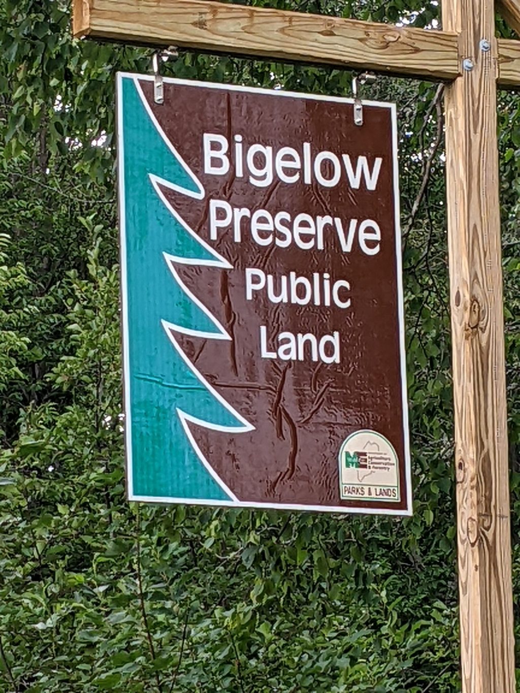
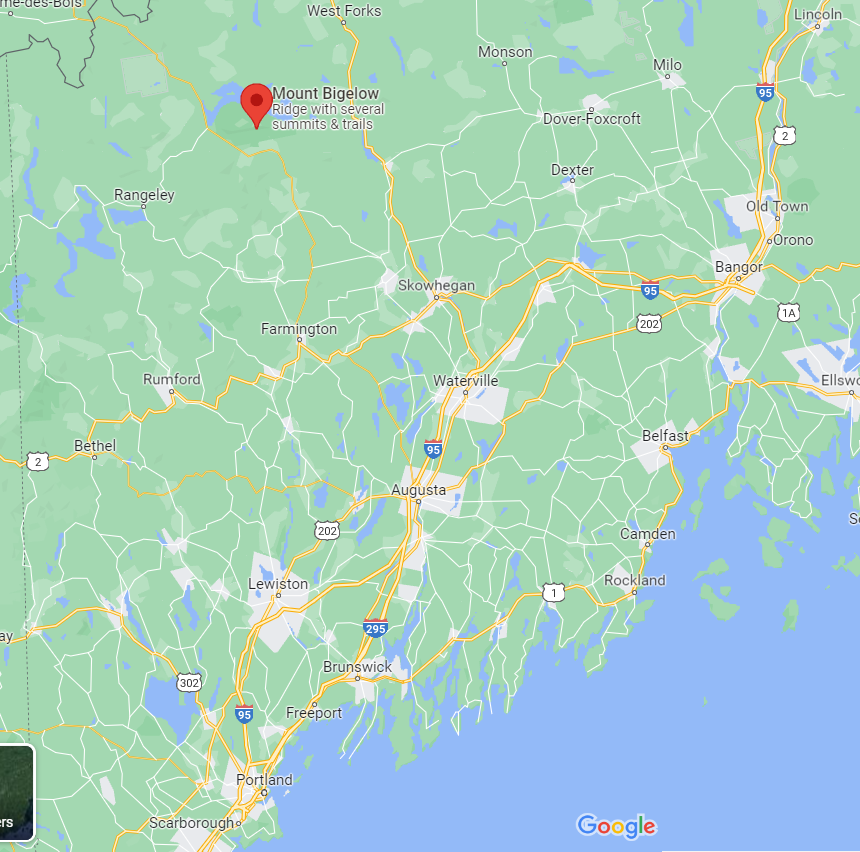
I’ve had my eye on the Bigelow Range Traverse in Northwest Maine for some time now.
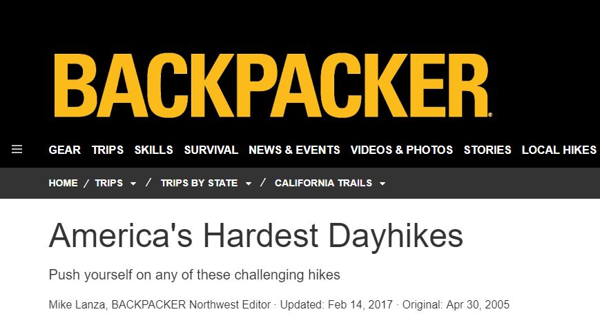
Ever since that damn list from Backpacker Magazine came out…..
- Timberline Trail – Mt. Hood, OR
- Pemi Loop – White Mountains, NH – Done 2015, 2017, 2020
- Great Range Traverse – Adirondacks, NY – Done 2019
- Windom Peak – San Juan Mountains, CO
- Cactus to Clouds Trail – Mt., San Jacinto from Palm Springs, CA
- Great Smoky Mountains End-to-End – TN/NC
- Grand Canyon South Rim to North Rim – AZ
- Enchantment Lakes Traverse – Cascade Range, WA
- Paintbrush Canyon-Cascade Canyon Loop – Grand Teton National Park, WY
- Bigelow Range Traverse – Northwest, ME – About to be Done 2022
_______________________________________________________________________________________________
Here’s what the Editors at Backpacker had to say:
10. Bigelow Range Traverse
Maine
Score: 64 Miles: 17 Elevation Change: 10,000 feet
X Factor: Black flies with attitude
You’ll be tempted to run this northbound traverse of the AT from ME 27/16-not because you’re feeling jaunty, but to escape the Maine woods’ infamous black flies. But the relentlessly steep and rocky trail along long, forested ridges discourages any such fantasies. The trail gets ruthless on the fierce half-mile climb to 3,331-foot South Horn, the ridges are waterless, and the summits windy and exposed. But the wild-north panoramas stretch all the way to Mt. Washington. Contact: Appalachian Trail Conference, (304) 535-6331; www.appalachiantrail.org
_______________________________________________________________________________________________
I know, I know – I refer to this list a lot. But, I took it as a personal challenge to tackle the ones within driving distance from Boston.
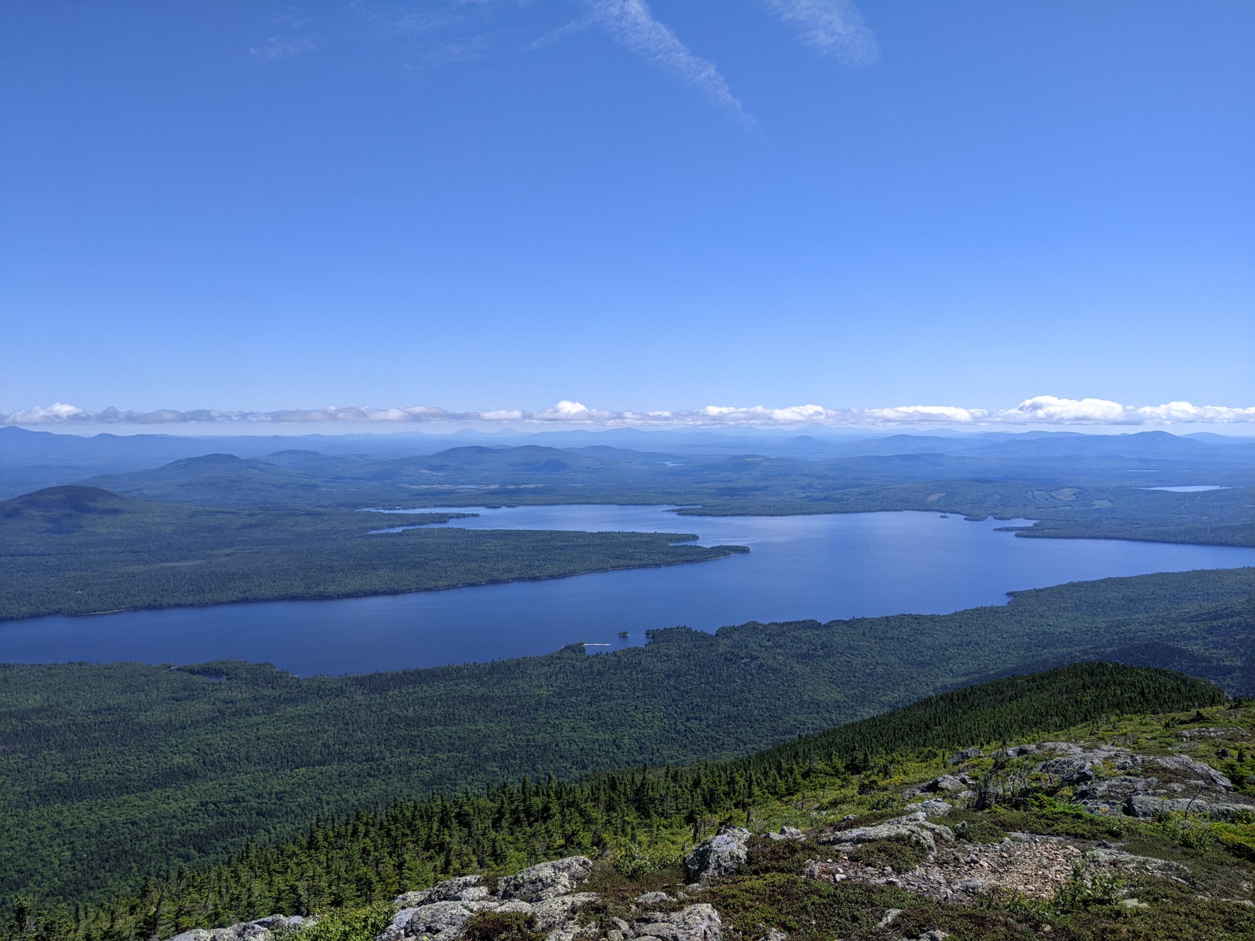
Bigelow way down at number 10 surely is not the hardest, but Oh my – that region of Maine is fully gorgeous and lured in my sentiment.
The range is pushed right up against Flagstaff Lake. Water + Mountains = Fairytale views.
I’m Bilbo traipsing through the Shire. 😊
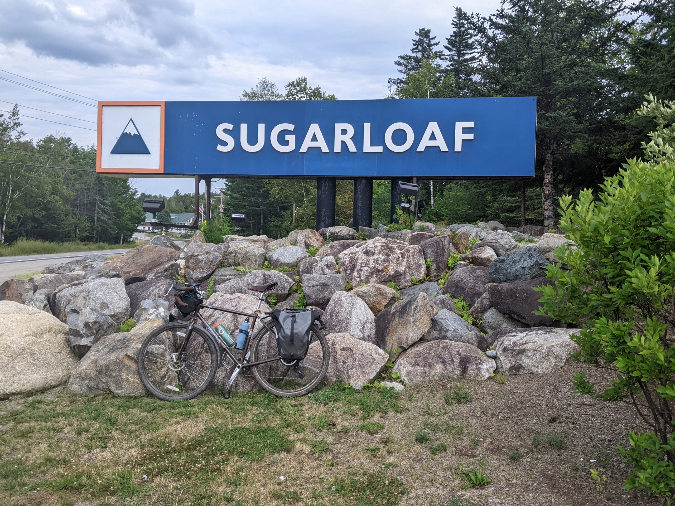
For you Northeast skiers in the know, The West end of the Bigelow Range is up near Sugarloaf – Again, about 4 hours from Boston.
Trailheads are easily accessed from the local roads, but be warned, driving around the range takes a good 40 minutes or so.
Not fun.
Doing this solo meant I had to do the drive twice while spotting and retrieving my car.

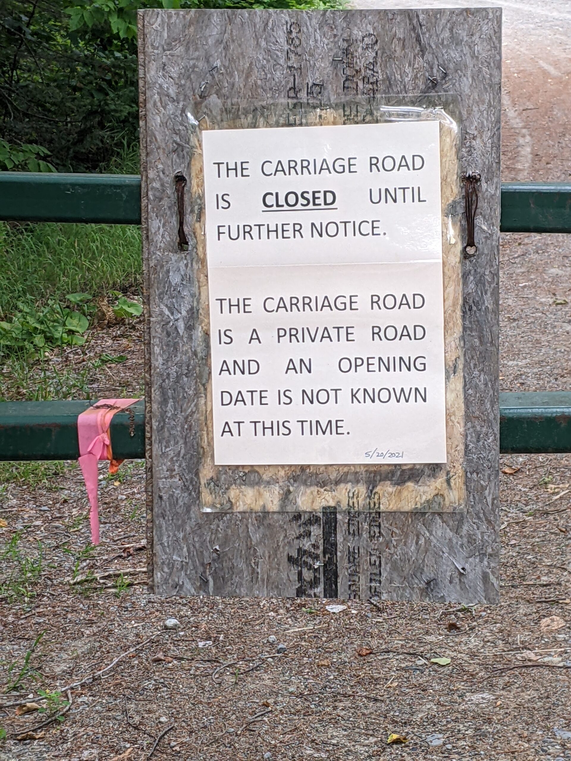
For those of you yelling out, “Hey Steve you coulda cut that looping corner by taking Carriage Road!?!?.”
You all and Google Maps are WRONG!
More compounded and unplanned commuting pain of the pre-hike logistics were still to come. This event turned out to be a two-day adventure instead of one.
Hubris got the better of me and I paid for a lack of attention to the details.
Here’s the story.
The Bigelow Range Traverse is a point to point hike of 17ish miles.
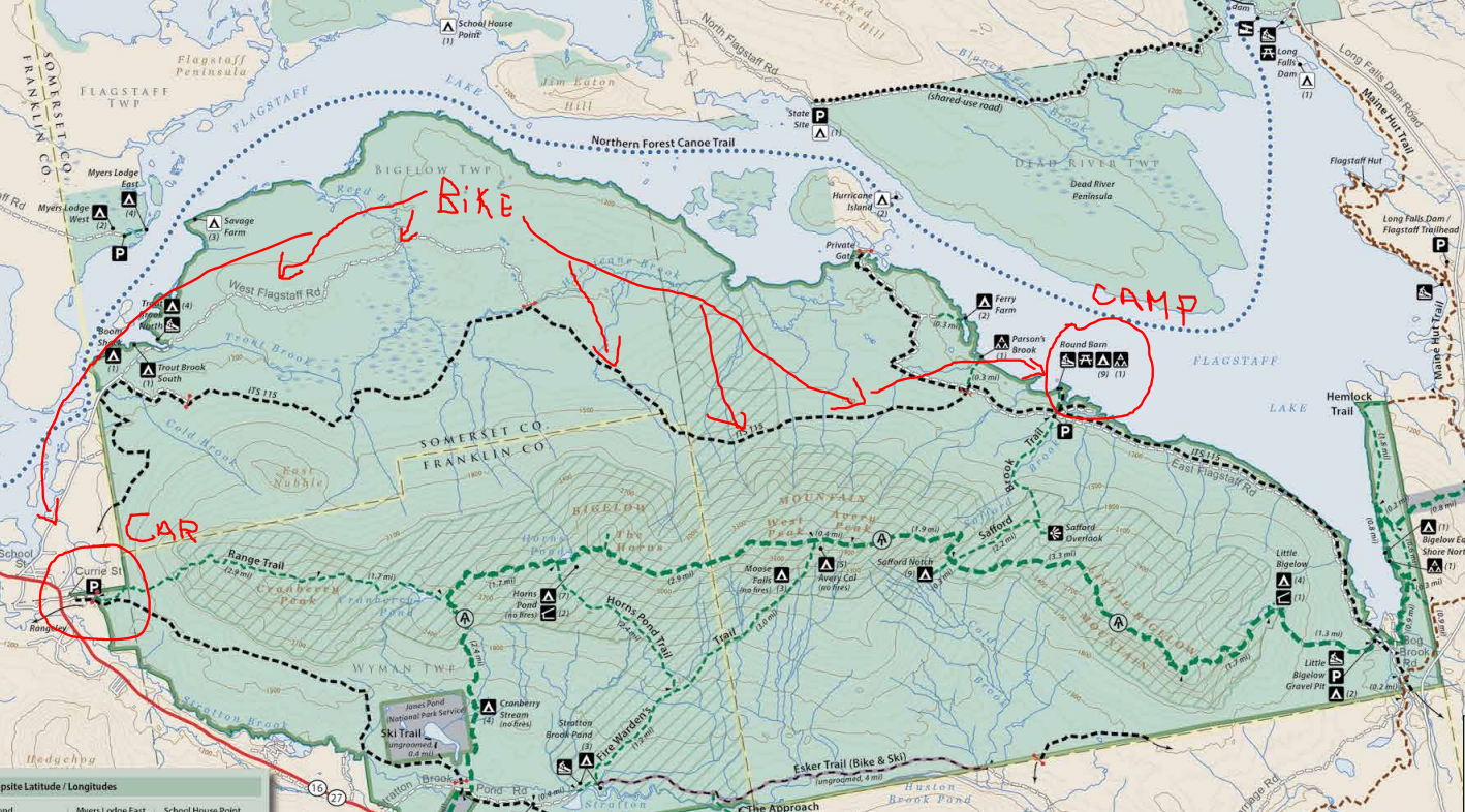
Just like Devil’s Path last year, I had to spot my car at the finish the day before and bike back to the campground where I tented close to the start – Little Bigelow Trailhead.
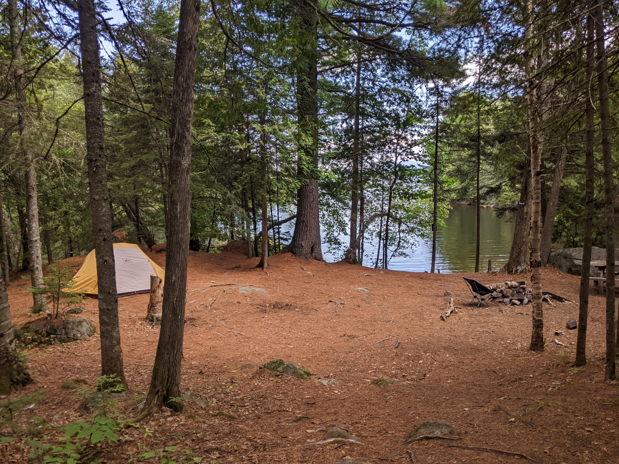
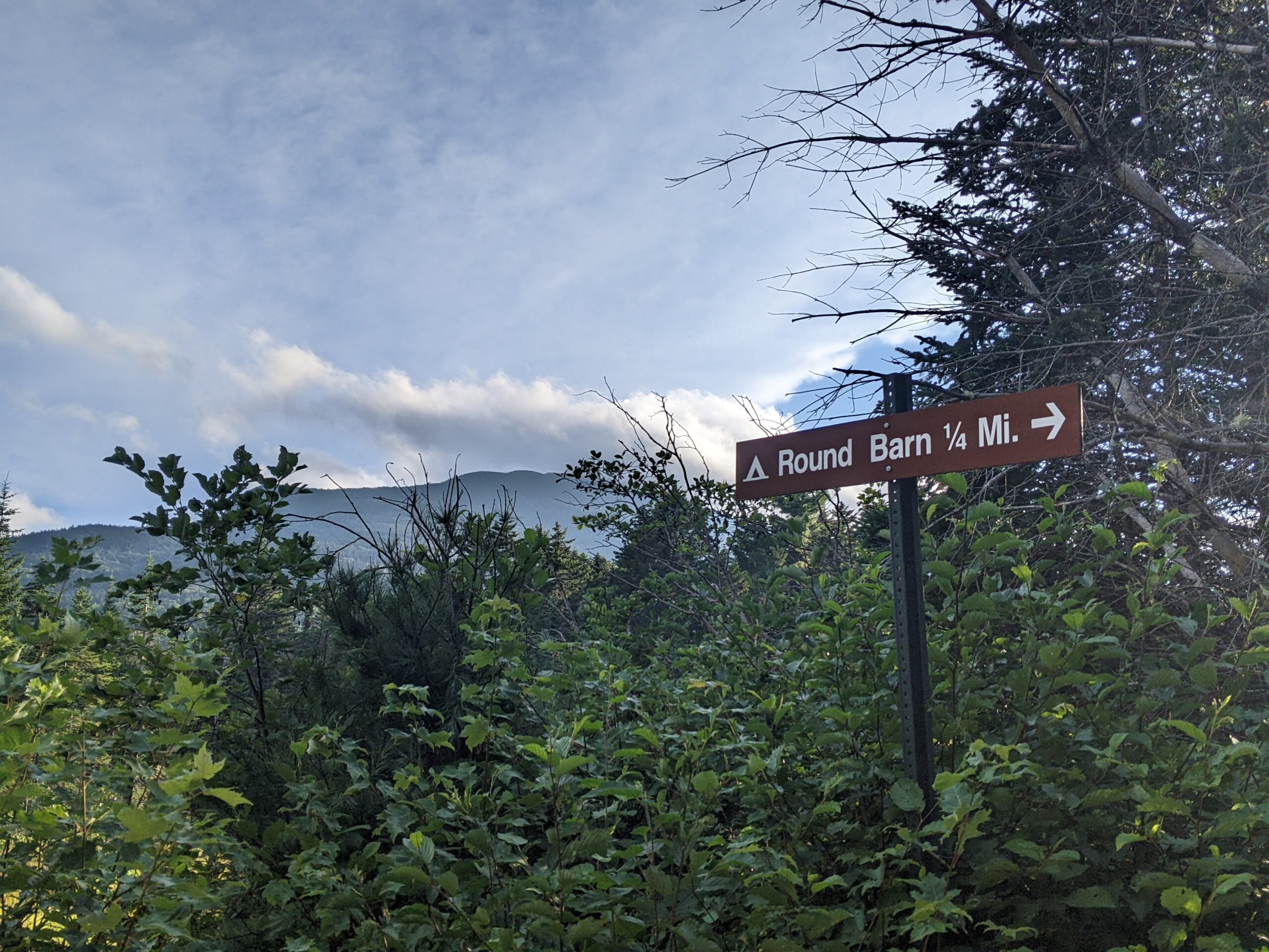
After securing this lovely (and free) camp site at Round Barn on the lake and East end of the Range:
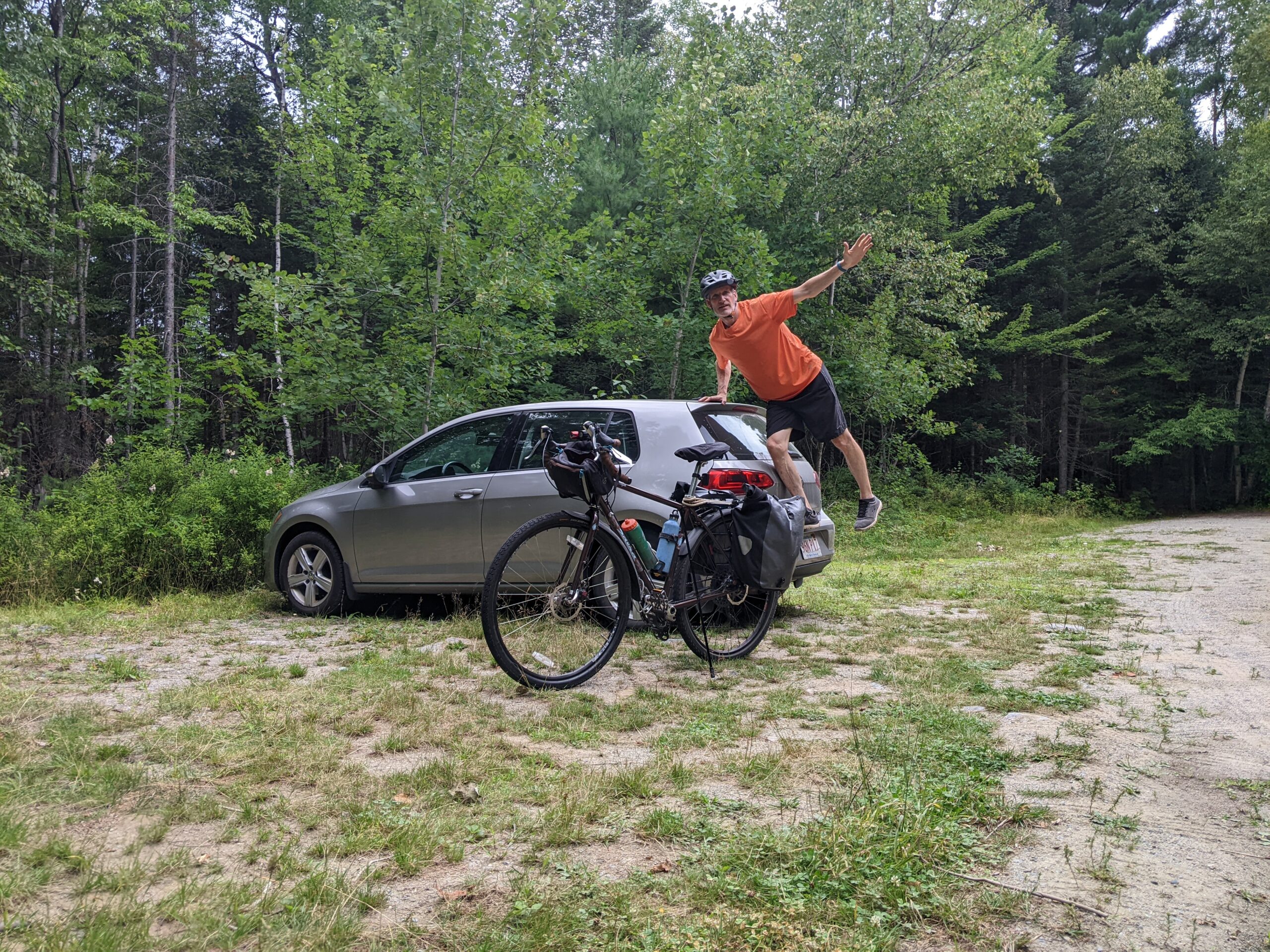
I drove my car with the bike in the back to the West side of the range where I would end the hike – Range Trailhead just south of Eustis, ME.
All amped up here for a leisurely 12-mile dirt road pedal along the lake back to camp.
Easy!
Except – It wasn’t. Substantial effort and mental pain were soon to follow.
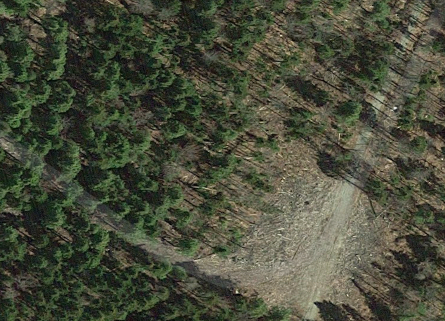
Zooming in on this local map you can see I’m to follow West Flagstaff Road to ITS115 snowmobile trail to East Flagstaff Road where I was camping.
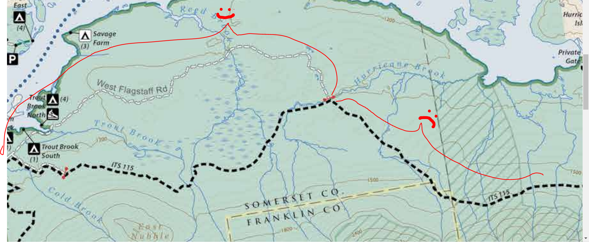
Ignoring “snowmobile trail” and keying in on the thickness of that dashed line on the map. I was assured that this was all rideable.
Bold dashed lines mean easy trail / gravel road – is the narrative in my head because that’s what it always is.
Except not here. Not on this map.
Snowmobile routes up here are just cleared of trees and they are not really suitable the other 3 seasons for even ATVs. Definitely not bikeable. I know this now. I did not then.
So after driving 40 minutes around the range and pedaling the 6 miles down West Flagstaff Road, I’m stopped and staring at a closed gate across the road flanked by trees and overgrown brush.
Road ends. ITS115 begins.
My brain doesn’t compute what’s happening. U-Turn. Back up the road a ½ mile.
Surely there’s a path to another road?
Nope.
Reading glasses on now, I take a much closer look at the map.
ITS115 with dark dashed lines = snowmobile route
Snowmobile Route = Not bikeable.
DUH!!! I’ve learned something new. Good for me.
Bad for me in the moment are the only two available options:
- Ride the 6 miles back on West Flagstaff Road then 30 miles back around the range – (NO!).
- Get off the bike and start pushing for 6 miles – Continue forward.
I stubbornly hate backtracking. So without much debate, Option 2 it is.
No trees on the trail, but this late in the summer (August), the brush is thick, overgrown, and damp.
It’s so dense and tall that my feet disappear under it with each step.
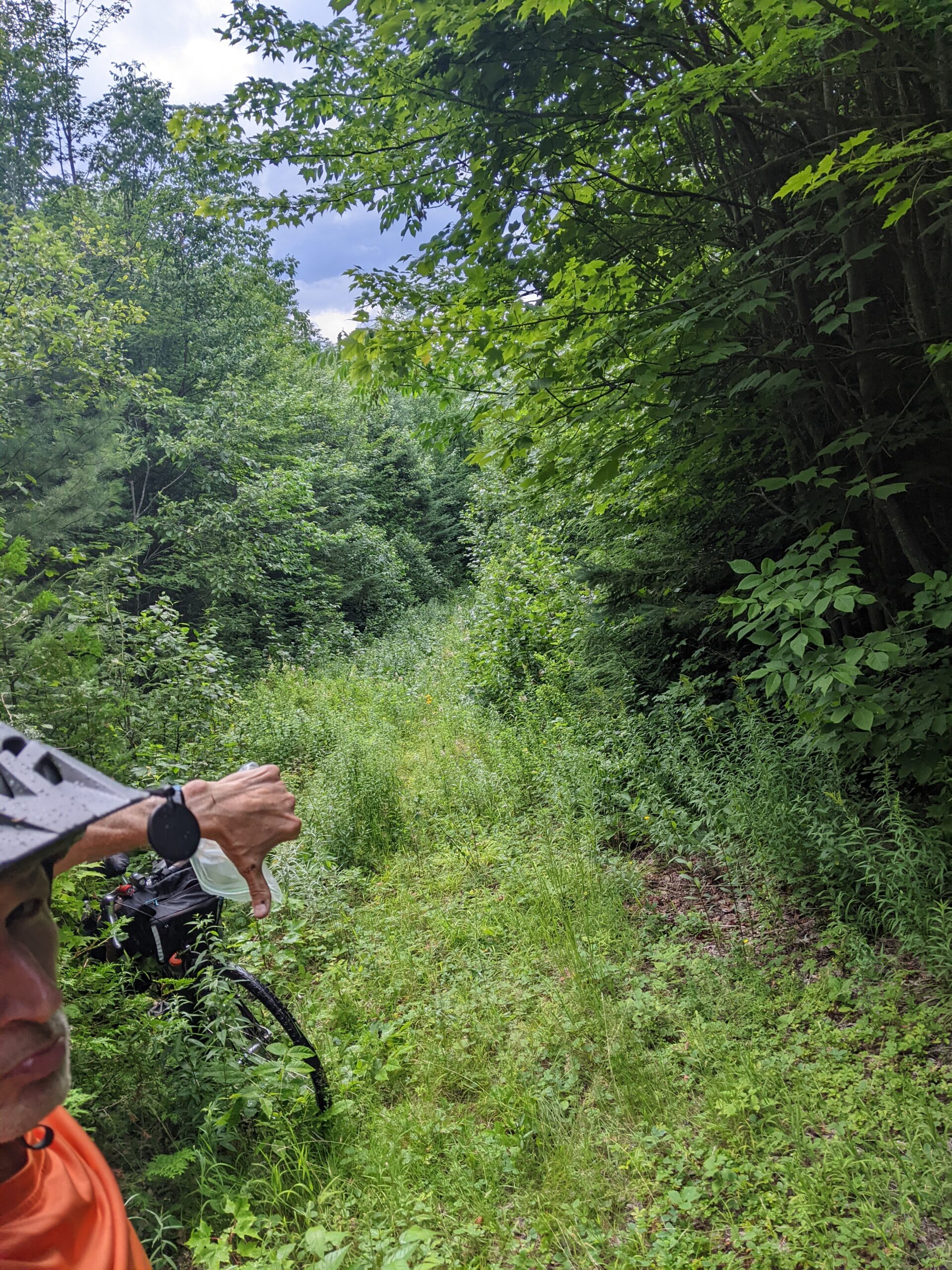
Rolled ankle territory I think, but don’t care.
This flub. This error in planning. This detour needs to be righted. Mentally, I’m not lingering on any mistakes.
I’ve flipped a switch. It’s game on and I’m charging ahead. GET THIS FUCKING DONE!
Now 3pm on this desolate, untraveled path, I’m motivated by the fading day. No way I’m going to be out here on a Hike-A-Bike folly in the dark – Just me and the black bears. ☹
Along with that notion is the wet, low laying forest.
This is the Shanghai of mosquito cities – And it’s rush hour.
They are everywhere. My arms, head, and legs are in full seizure mode – swinging, swatting, slapping anything within the radius of my appendages.
When this episode subsides after getting more bug spray on, I’m reassured by the fact that the two panniers attached to the rear bike rack are packed with supplies. I’m easily carrying a two day’s worth of food and water along with rain gear, headlamp, and most important a full can of the aforementioned bug spray (thank God).
With anxieties eased and the acceptance of my new reality, the trail pitches up.
Step, drag, step, drag. Me and the bike effort along
It’s humid, but not crushing. A nice even layer of sweat coats my body. I deliberately and vocally remind myself to drink lots of water and eat calories. Can’t start tomorrow’s main event all dehydrated and depleted.
One major mistake is enough for today.
An hour in and the trail is still going up. WTF?
This is frustrating in the moment, but I just move relentlessly forward knowing that up will turn to down at some point.
Get this done sooner than later. Need rest. Need to get ready and organized for the hike across the range tomorrow.
This thought runs on a closed loop in my mind.
Why hike tomorrow? You’re hiking right now.
I’m mocking myself. HA! Idiot!
Serve your penance for amateur planning. Skipping the hike across the Bigelow Range, the reason I’m up here….
…Is NOT an option.
MOVE!
Hour 2 turns to hour 3 and I have yet to see, hear, smell, or get a feeling of any people or signs that I’m near some civilization or place where other humans might be.
I’m very alone in the woods (pushing a bicycle).
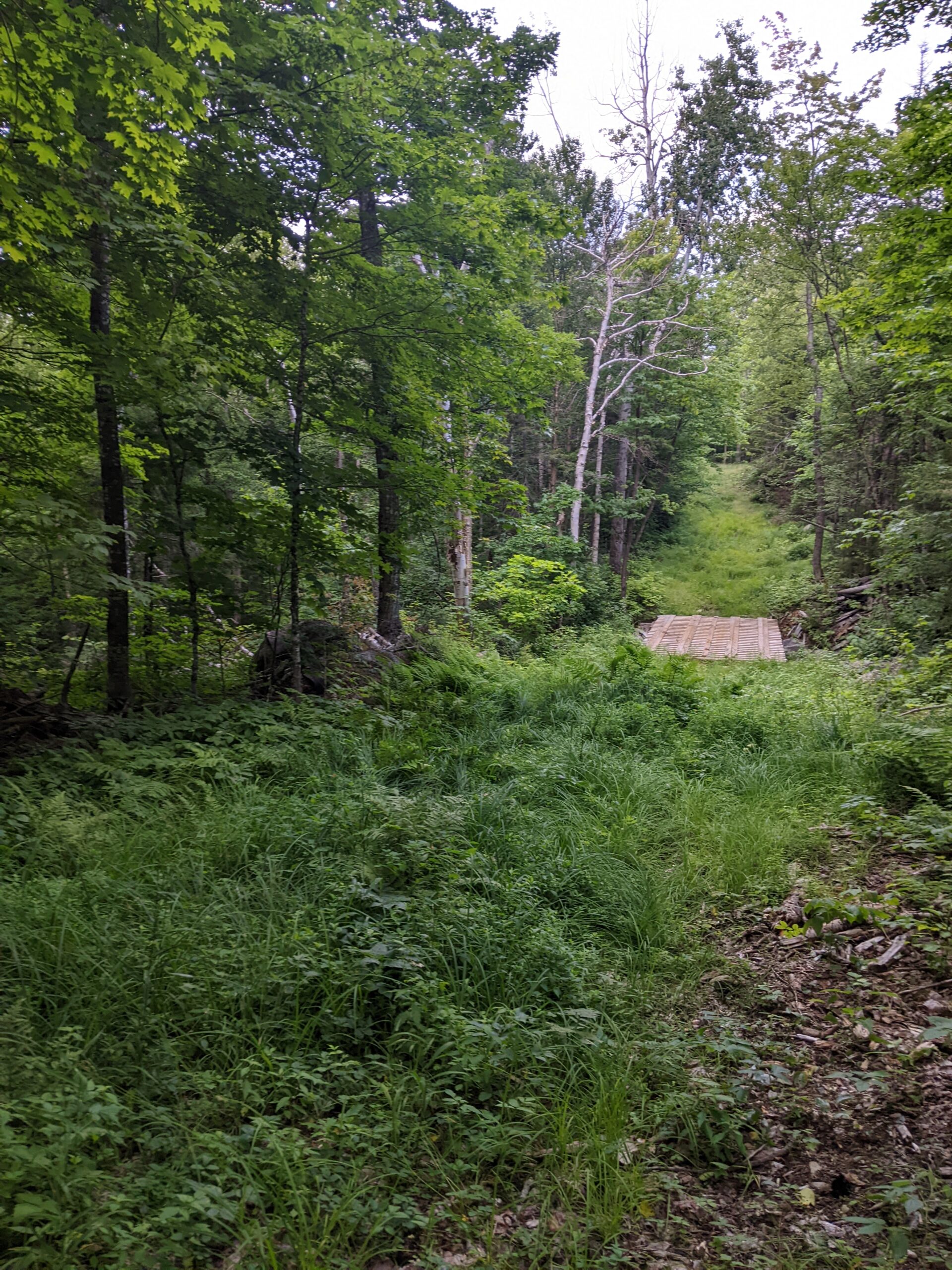
Finally, the trail hits its peak. The brush is less dense, but the ground is mudded, rocked, rutted, and rooted.
With a little gravity assist, I pick up the pace. Now 3 and a half hours into what I’m calling Stage 1 and the sun setting fast behind me, this really needs to be done. Or at least I need to see some cues that tell me I’m close to??? – Anything really.
Heaving the bike over and between rocks. Tearing it through tall grass and shrubbery. The poor old thing is being mistreated. This is bike abuse and not what we usually do as a team – I think I actually hear it whimper at one point.
I jump a leg over the frame hoping I can coast a bit of the downs and give those hiking legs a breather. Heavy on the brakes and weaving around soccer ball size rocks into mud patches ceases any hope of riding. It’s not doable.
Back to quick walking pace.
By this point it’s all laughable and I’m grateful to be in high spirits.
Not how I planned the start of the trip. But you know what? Who cares. I’ve trained all spring and summer to be here. The tree canopy overhead has escorted me with prime shade the entire way. I’m on top of staying hydrated and eating through this mini epic.
And LOOK!!!
….This trail is widening out up ahead. Am I finally done?
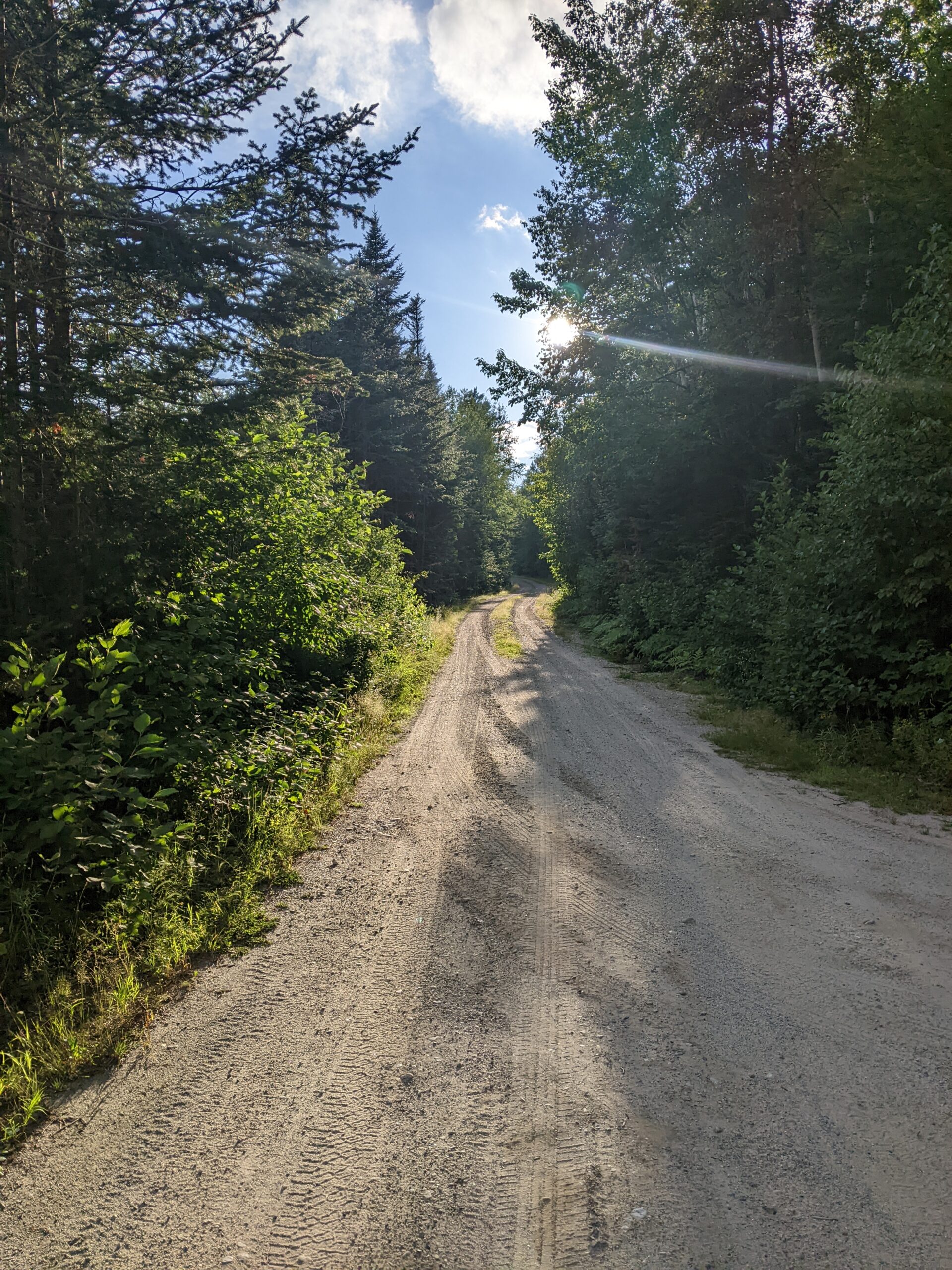
Yes. I’m dumped out into a small field with a double track road off to left. You know, wide trail with a path for each side of the car and grass growing in the middle.
This is drivable so it’s definitely bikeable. I jump on and am whisked down my new favorite road at a gravity assisted 25 mph. Heaven.
One minute later and we’re at East Flagstaff Road. I know exactly where I am. MADE IT!
A tidy half mile pedal southeast and bingo.
Back to the world.
How I didn’t roll an ankle, step on a snake or get poison ivy IS the miracle of this calamity.
Sweet Jesus thank you.
I hustle up into the campsite and immediately make good use of the remaining hour or so of useable daylight.
- Day pack and hydration bladder loaded and prepped for tomorrow.
- Run/hike clothes unpacked.
- Cook kit prepped to start breakfast tomorrow at 4:30am
- Bear bag with food and toiletries hoisted high and away from camp.
Diving into the tent at twilight, it’s all forward thinking. Yes, I messed up today. But, what a motivated slog through parts of the Bigelow Preserve I never would have seen otherwise.
Not so bad – I think.
I turn on the small radio tucked into the ceiling pocket of the tent thinking 10 minutes of news will calm me down.
Not even a minute after my head hits the pillow, my beleaguered achy body falls fast asleep.
I’m out.
So deep that no dreams are remembered.
What a day 😊
*********************************************************
Part II with Pics and Descriptions of the actual hike across the range coming in a few days.

Leave a comment