The Carter-Moriah Range.
You want to tackle this one in a day?
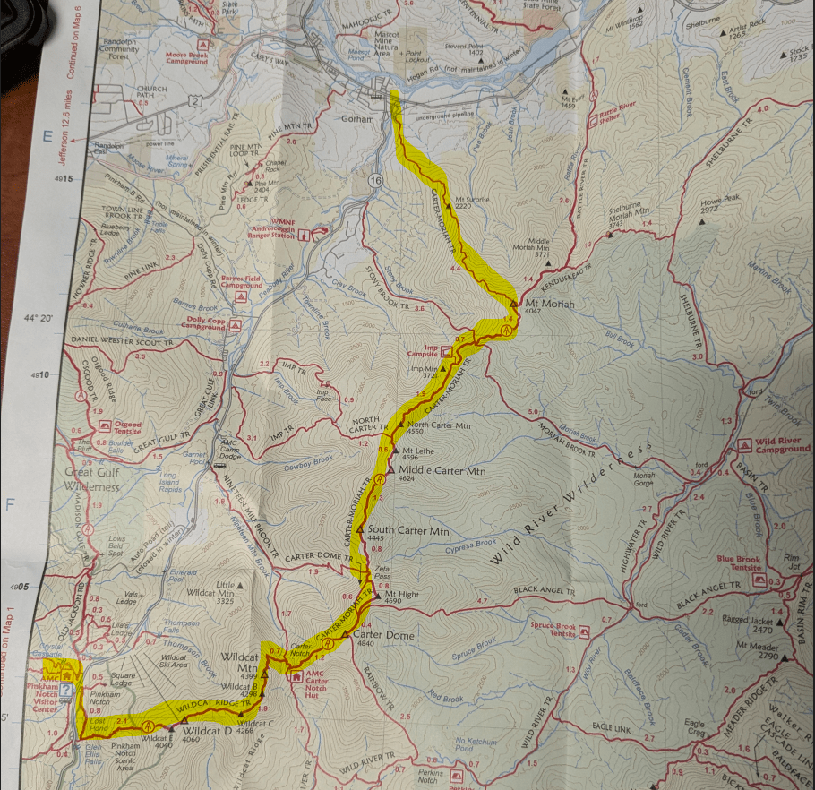
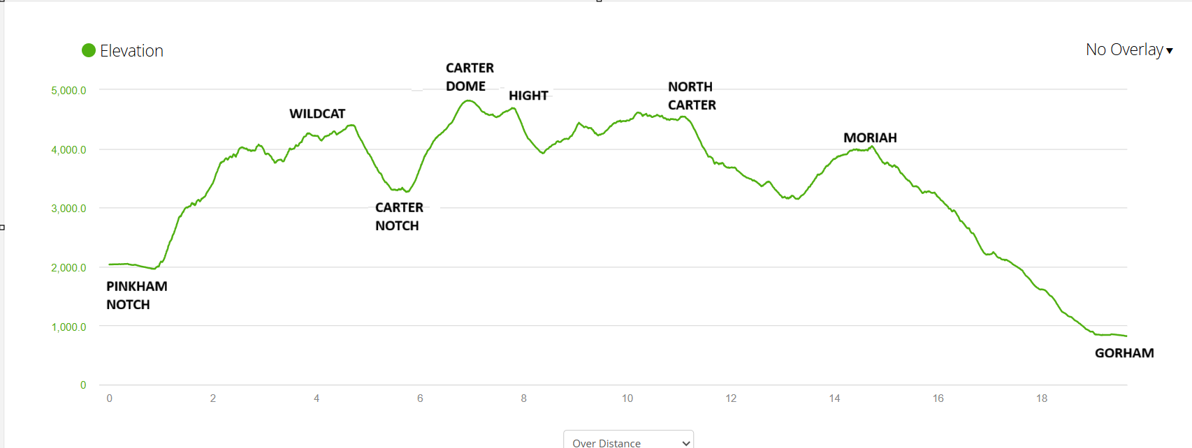
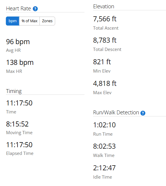
Distance: 19.7 miles
Time: 10-14 hours (Depending on your pace)
Elevation Change: 16,349 feet (7,566 ascent)
Direction: South to North
Start: Pinkham Notch
End: Gorham Center
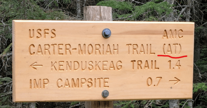
Trails: Wildcat Ridge Trail to Carter Moriah Trail.
I’ve been wandering these peaks over the last two years.
- Up to Mt. Hight and Carter Dome.
- Meanderings around the hut at Carter Notch.
- Some gratitude daydreaming at the mountain lake there.
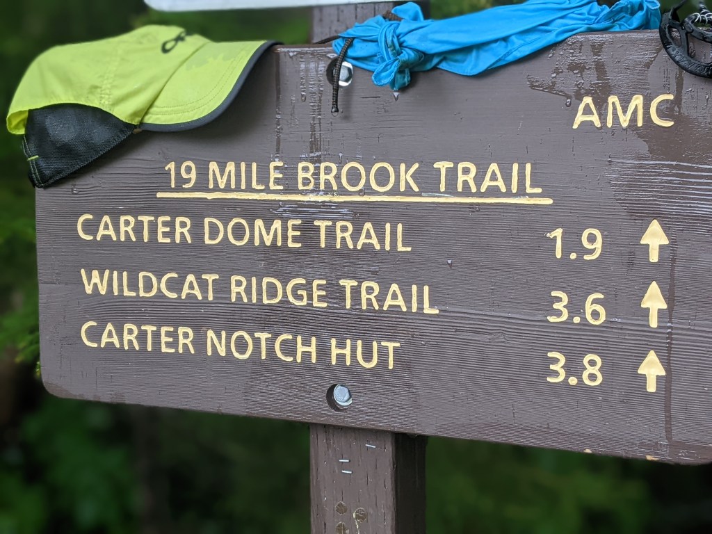
- A little trail running up by Camp Dodge and out 19 mile Brook Trail.
So, when deciding which long, challenging endurance hike to do this year, the internet unveiled the Carter-Moriah traverse. I guess this wasn’t obvious when mapping my shorter hikes – Old man brain ☹
As always, reading a few hiking blogs romanced me right into the full South to North passage.
Oh Yeah, throw in Wildcat too cuz it’s right there.

19+ miles, 7,500 feet of ascent, 10+ hours from Pinkham Notch to Bangor Street in Gorham.
I strongly suggest doing this one South to North. In my view the most strenuous parts are up and over Wildcat, down to Carter Notch, then up to Carter Dome. South to North – This is done in the first 7 miles. Better on to be on fresh legs at the beginning of the day than trashed legs, feet (and mind) at the end.
LOGISTICS
As a point to point hike and me as a solo hiker, there’s getting to start and home from the finish.
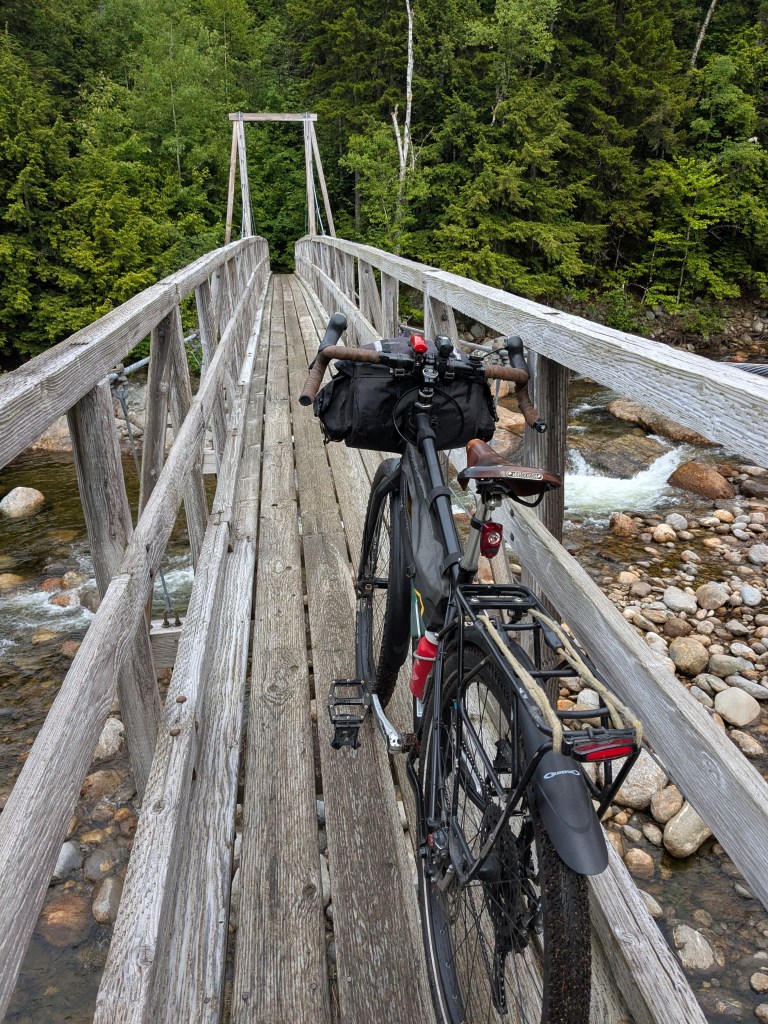
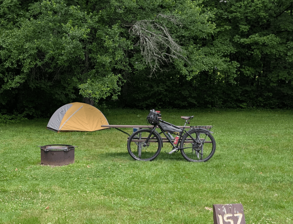
Not a huge obstacle here. Just like the Presidential Traverse in 2023, my bike comes into play.
Handy for sure.
The required pedaling ain’t that much with Dolly Copp Campground situated right off Route 16 kinda in the middle of it all.
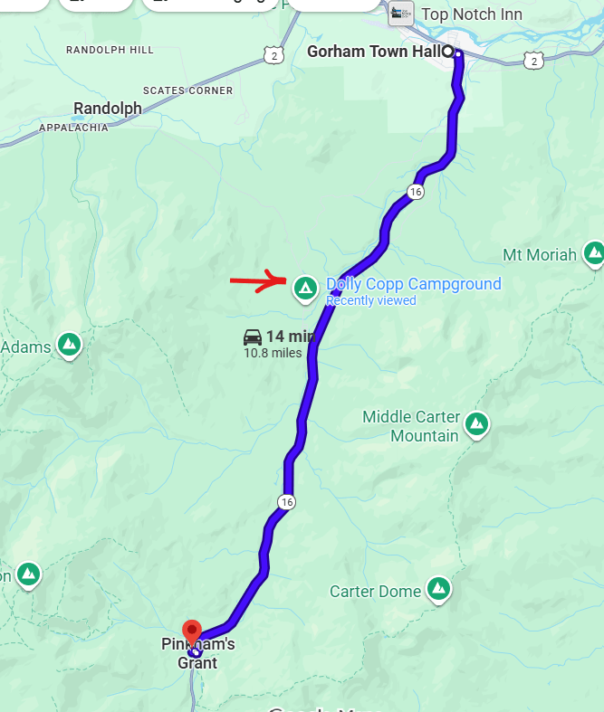
So the day before the hike I stopped in at City Hall in Gorham center (also the police station) to make sure overnight parking is allowed.
Yes indeed! Plenty of room for us ambitious hikers on Railroad Street paralleling the playground / park at Route 2 and Route 16.
The Trailhead in Gorham is situated in a very small neighborhood cul-de-sac that really doesn’t offer that much parking. As a courtesy to the residents just park in the center.
You’re already in hiking mode so a little road walk (5-6 min.) isn’t gonna kill you. Don’t be the greedy shopper who just HAS to park as close to the entrance as possible.
I left my car in the center then biked back to camp at Dolly Copp – 4ish easy road miles.
Next morning I’m up at 4am to get all prepped for a full day in the mountains. (Don’t forget sunscreen on your face) 😊
The bike ride to Pinkham Notch ain’t the easiest. A bit of uphill over 7 miles.
But I cherish daybreak always and turn off my headlight a couple times to fuel up on the dawn colors filling the sky. I just treat this as part of the adventure and it feels rewarding to be self reliant with the trailhead commuting.
Steve – the Wildcat Ridge Trail starts across from Glen Ellis Falls – Why not ride the extra ½ mile to there?
Yeah, I know – a couple reasons to depart from Pinkham.
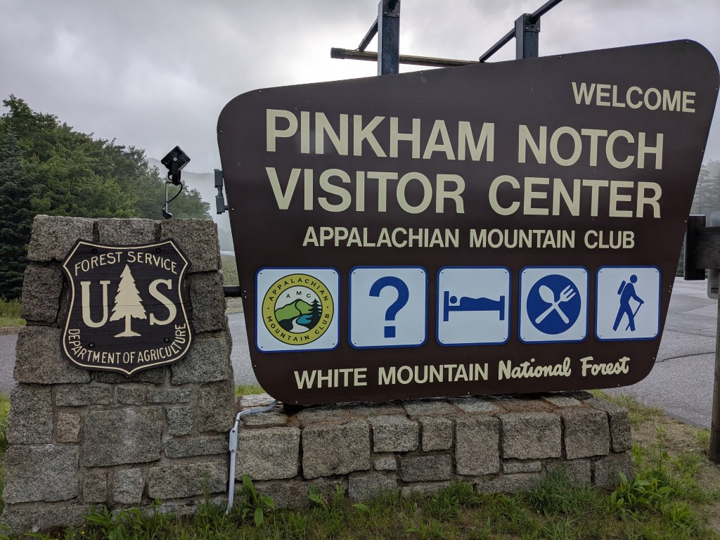
First, I just love the vibe right there at the base of Mount Washington. It’s a-Buzz with many motivated hikers milling about and prepping their launch into the Presidential Range.
Plus there’s a proper bike rack to lock up to right in the village.
No need to haul in water from the campground. Potable water spigot available 30 steps away.
Oh yeah – bathrooms too. Need that.
Walk across Route 16 and choose either the Long Pond Trail or a shorter + easier road walk to the start of Wildcat Ridge.
0.7 miles North.
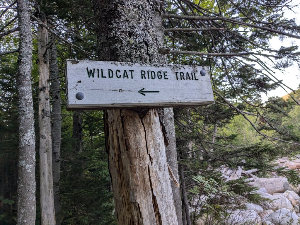
Finally!
The trail wastes no time getting vertical. Your heart rate is gonna elevate as quickly as the mountain in front of you.
Views present themselves straight away.
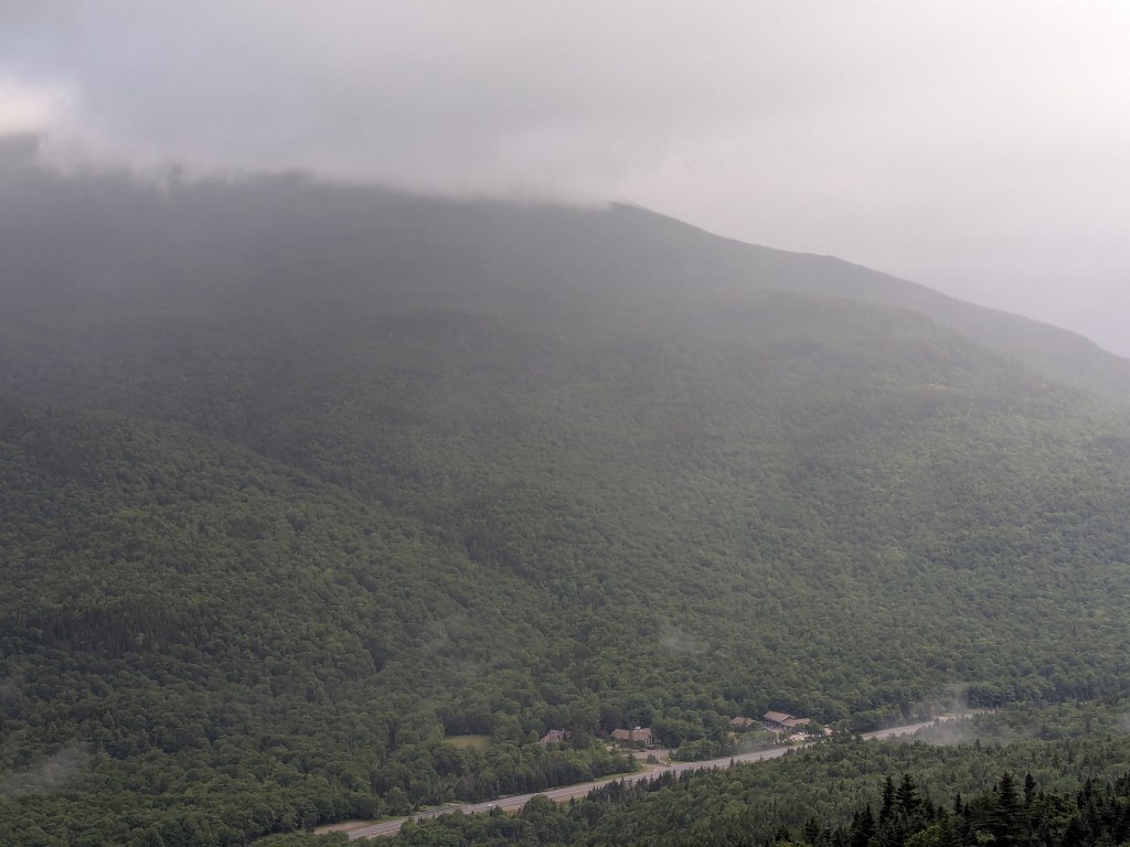
Wildcat Ridge Trail does a great service offering a natural viewing platform every 20 minutes or so to keep your mind from breaking apart on the steepest grades of the day.
Now we’ve got some real estate between us and the valley – We’re in the Mountains baby!
It’s early in the hike so enjoy the freshness of your leg strength and give homage to the North Bound Appalachian Trail thru hikers who just came off the Presidential Range and are doing what you’re doing with 25+ pound loaded backpacks – WOW!
The trail pops out at the top of the Wildcat ski slope.
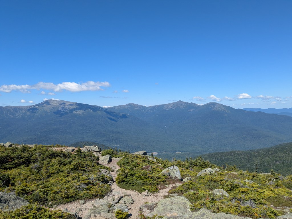
Mount Washington dominating the immediate Western view.

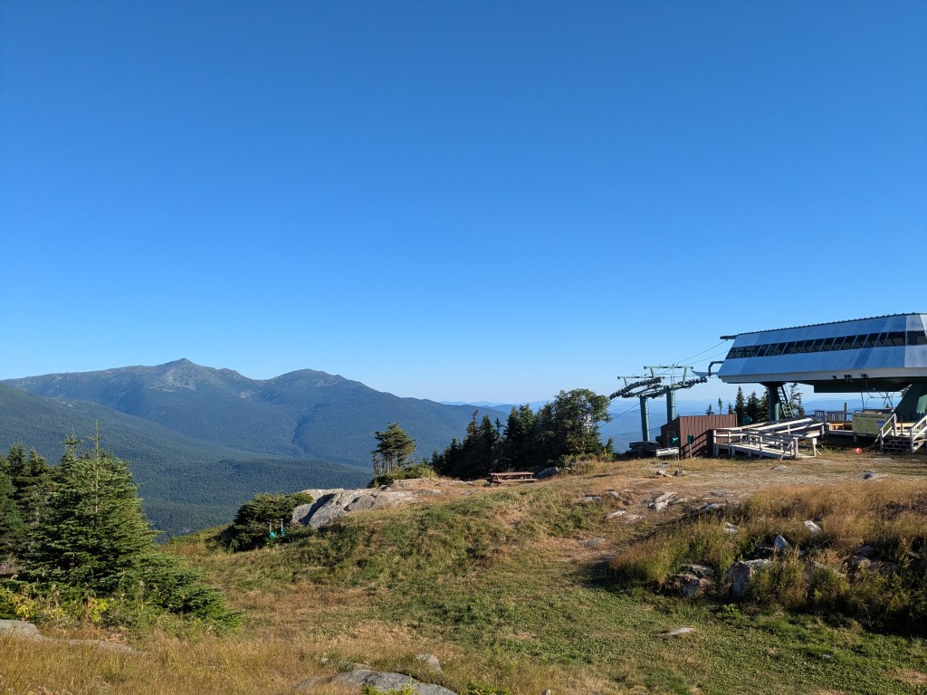
Madison & Adams looming across the valley
Don’t forget to look East
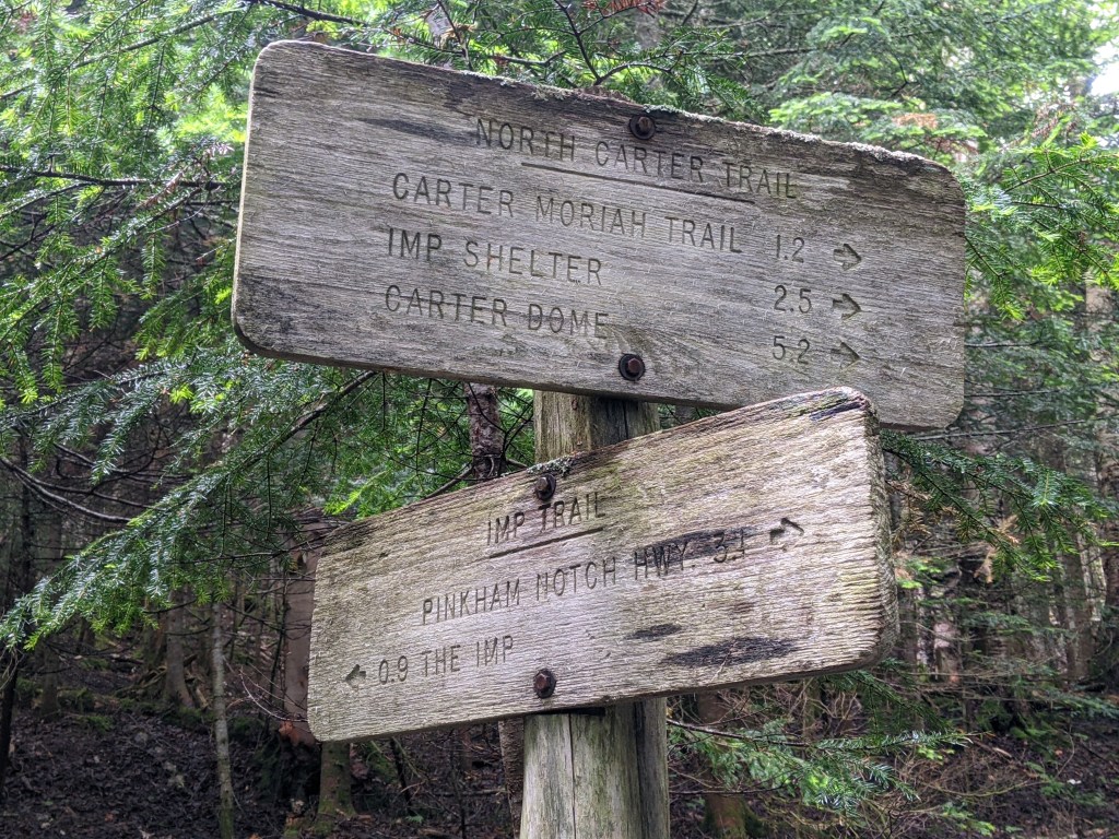
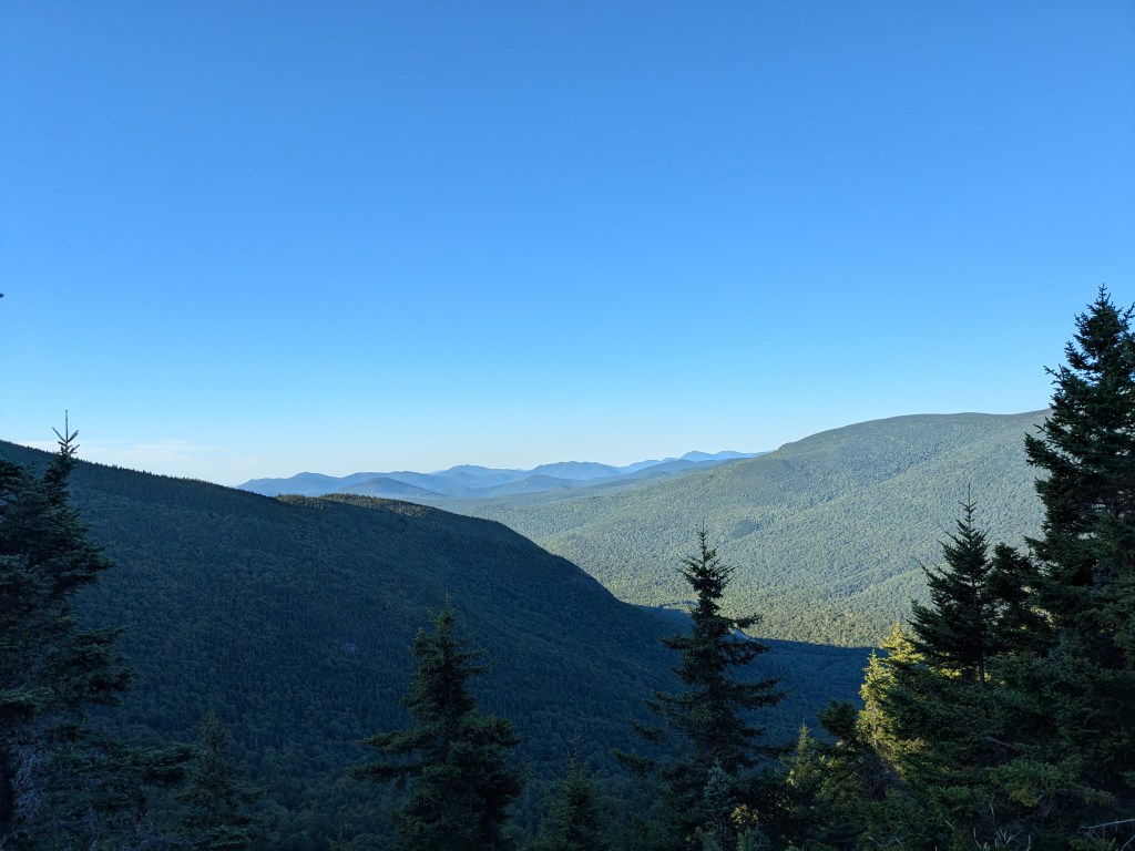
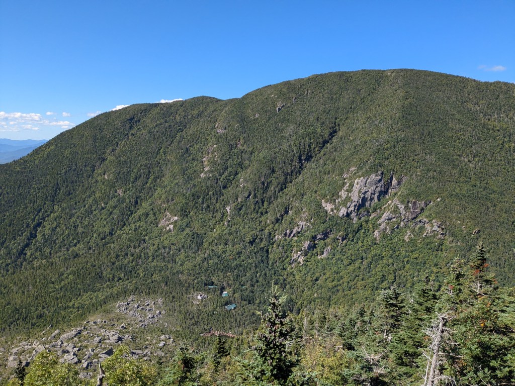
Another couple miles at the back side of Wildcat, Carter Notch unveils itself to give a preview of the next couple hours of your day.
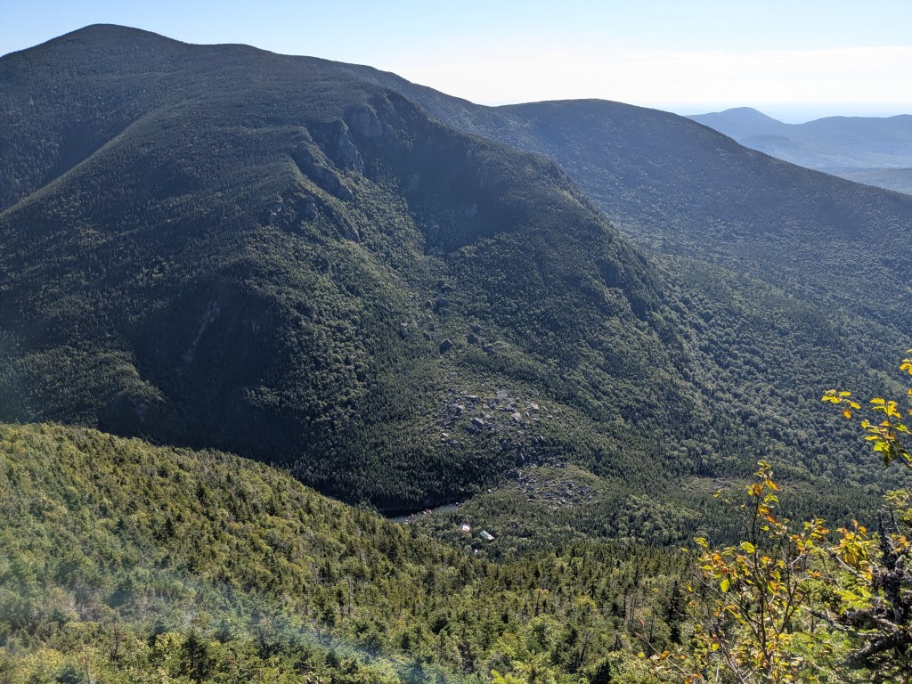
Having done some reconnaissance hikes around these parts, I planted some seeds of worry about this section – The descent off Wildcat and immediate ascent to Carter Dome.
But this turns out to not suck. With the morning slowly unfurling, legs and mind are still running in hyped mode.
Plus, timed the arrival to Carter Notch hut just right 😊
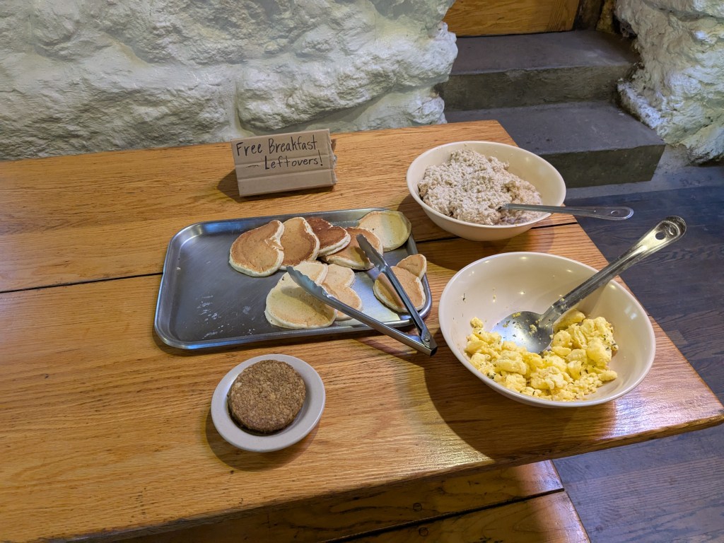
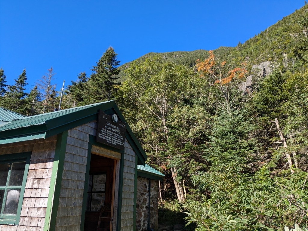
Top off your water, use the bathrooms and calibrate your mind for the ascent out of the notch up to the highest point of the day – Carter Dome.
Yeah, it’s steep, but not overly long. If you’ve been over in the Pemi and gone up to South Twin from Galehead Hut then you have the moxie to pull this one off too.
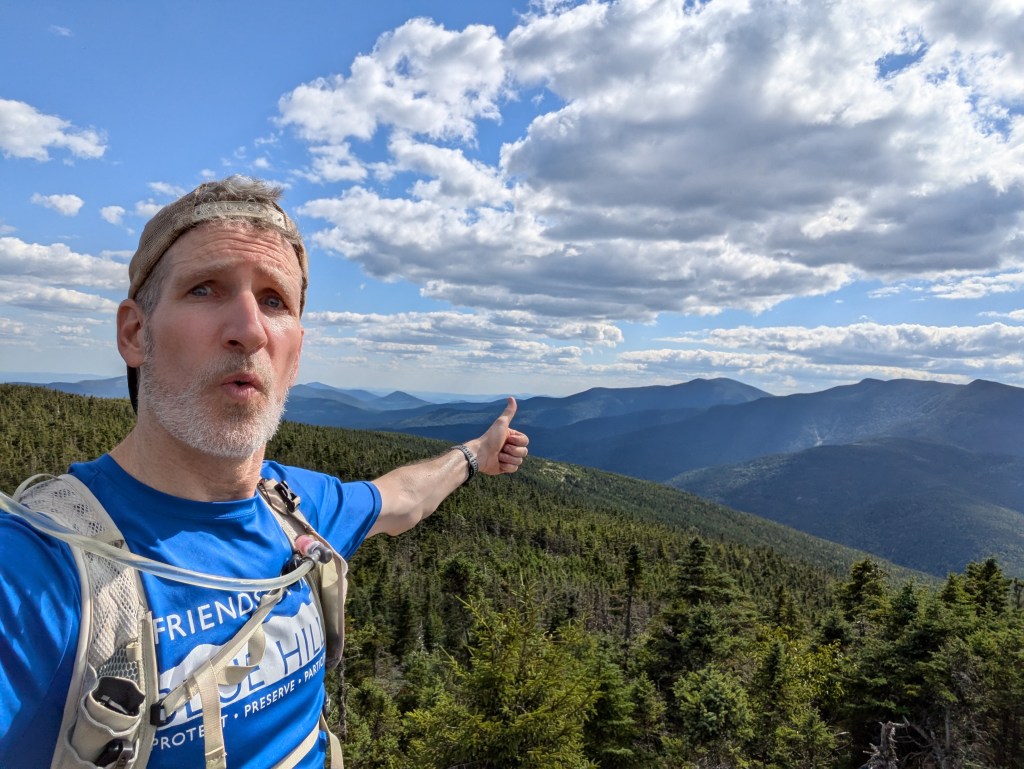
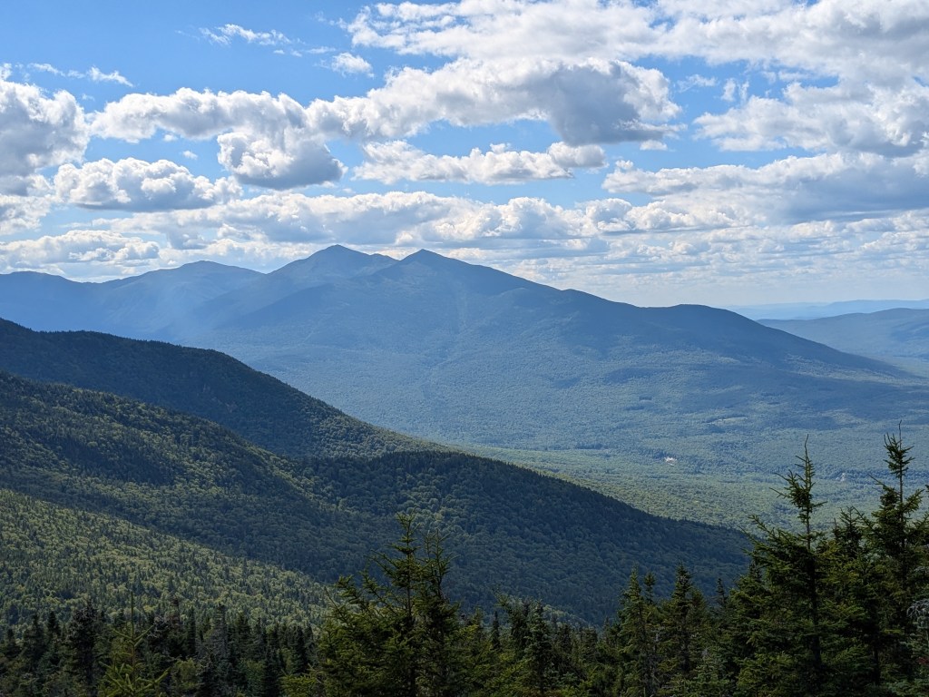
Once you peak out at Carter Dome you’ll do some chill miles over to Mt. Hight. There’s an option to skip this, but if it’s a clear day the view over to the Presidents is the best here.
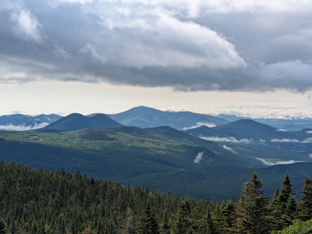
Over the next handful of hours, Middle Carter and North Carter come and go without too much strife. Though, I personally did not enjoy the decent off North Carter. My old joints don’t like the downs so much anymore. Much better and pleased with the ups.
Now just get over and up to Mt. Moriah. Be patient cuz there are a few moments when you’ll feel like the summit should be close, but it’s not there. Not really false summits just late day anxiousness.
Finally!
Now comes the long haul out. 4.5 miles may not sound all that long. But at the end of a full day on sore feet, it sure doesn’t go quick.
Most of this is runnable, but I chose not to. A little beat up and not feelin’ it so I just trudged out.
Not too many views to fill in the time, but you’ll feel the pull of the end.
A few peeks through the trees show roads and buildings coming into sight.
Good news is that this part of the trail is easy hiking.
Bad news is it’s a bit boring. Likely cuz I was anxious to just be done already.

Double Finally!!!

Writing this up a couple months later, I’m really appreciating this part of the Whites.
With the Presidential Range right across the road, Carter Moriah is less popular with the tourist hikers. Mostly New Hampshire regulars traipsing these trails.
Yeah, you don’t get up as high, but I really feel connected and tuned into the landscape and chill vibe around Carter Notch.
Take this one on people you’ll feel that connection too👍


Leave a comment